
Parcel 10-2N-23-0000-0004-0000
Owners
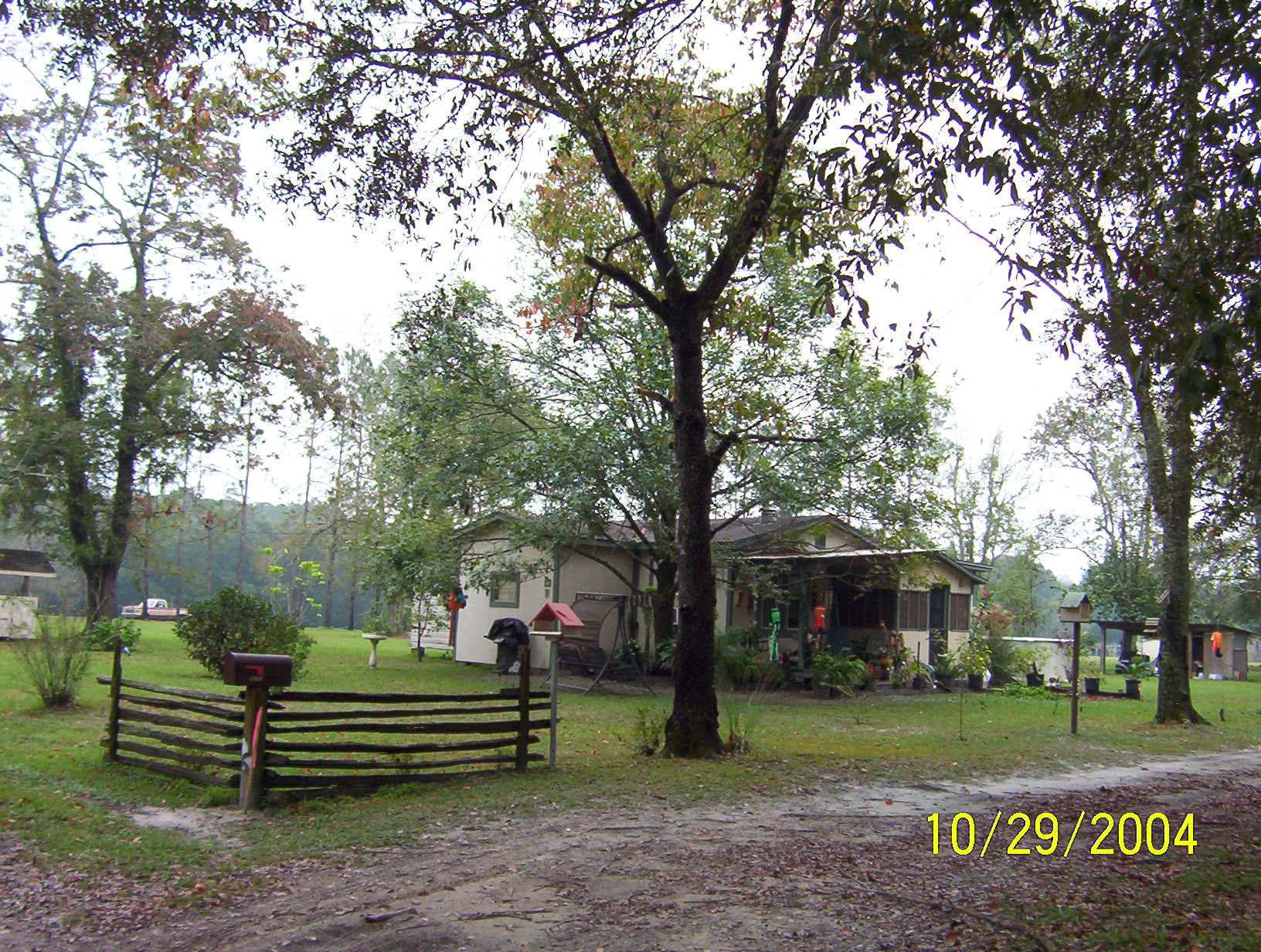
3171 JESSIE RD
HILLIARD, FL 32046
Parcel Summary
| Situs Address | 3171 JESSIE RD |
|---|---|
| Use Code | 0100: SINGLE FAMILY |
| Tax District | 6: Drainage Dist |
| Acreage | 1.1900 |
| Section | 10 |
| Township | 2N |
| Range | 23 |
| Subdivision | |
| Exemptions | HX: Homestead (196.031(1)(a)) (100%) HB: Homestead Banded (196.031(1)(ab) (100%) |
Short Legal
PT OF E1/2 OF SW1/4 OF NE1/4IN OR 2608/1153
EX ESMT OR 651/772...
Certified Values
| STANDARD | 2024 |
|---|---|
| Land Value | $35,700 |
| (+) Improved Value | $77,955 |
| (=) Market Value | $113,655 |
| (-) Agricultural Classification | $0 |
| (=) Assessed Value | $113,629 |
| (=) County Taxable Value | $63,629 |
Document/Transfer/Sales History
| Instrument / Official Record | Date | Q/U | V/I | Sale Price | Ownership |
|---|---|---|---|---|---|
| SW 2608/1153 | 2022-12-15 | U | Improved | $100 | Grantor: HOLTON DAVID W Grantee: HARDWICK SHAWN A |
| QC 1703/1917 | 2010-12-20 | U | Improved | $100 | Grantor: NELSON RICHARD & GRACE Grantee: HOLTON DAVID W |
| TD 1647/0126 | 2009-10-21 | U | Improved | $5,000 | Grantor: CLERK OF COURT Grantee: HOLTON DAVID W |
| QC 1196/1348 | 2003-12-19 | Q | Improved | $100 | Grantor: RAULERSON MARIE H Grantee: NELSON RICHARD A & NEVERLAND |
| WD 0817/1439 | 1997-12-23 | Q | Improved | $12,500 | Grantor: RAULERSON CHARLES & MARIE H Grantee: RAULERSON MARIE H |
| WD 0788/1601 | 1997-04-01 | U | Improved | $24,100 | Grantor: NIGHBERT NEIL Grantee: RAULERSON CHARLES & MARIE H |
| CT 0785/1582 | 1997-02-26 | U | Improved | $100 | Grantor: CLERK OF COURT Grantee: NIGHBERT NEIL |
| WD 0706/1649 | 1994-06-13 | Q | Improved | $13,200 | Grantor: RAULERSON CHARLES & MARIE Grantee: NELSON RICHARD & NEVERLAND |
| WD 0668/1953 | 1992-10-26 | Q | Improved | $32,500 | Grantor: NIGHBERT NEIL N Grantee: RAULERSON CHARLES |
| WD 0380/0181 | 1983-03-01 | Q | Improved | $13,100 | |
| WD 0252/0422 | 1977-11-01 | U | Improved | $12,000 |
Buildings
Building # 1, Section # 1, 40020, RESIDENTIAL
| Heated Sq Ft | Year Built | Value |
|---|---|---|
| 1040 | 1963 | $78,824 |
Structural Elements
| Type | Description | Code | Details |
|---|---|---|---|
| EW | Exterior Wall | 05 | AVERAGE |
| EW | Exterior Wall | 04 | SINGLE SID |
| RS | Roof Structure | 03 | GABLE/HIP |
| RC | Roof Cover | 03 | COMP SHNGL |
| IW | Interior Wall | 04 | PLYWOOD |
| IF | Interior Flooring | 14 | CARPET |
| AC | Air Conditioning | 01 | NONE |
| HT | Heating Type | 02 | CONVECTION |
| BDR | Bedrooms | 3.00 | |
| BTH | Bathrooms | 1.00 | |
| FR | Frame | 02 | WOOD FRAME |
| STR | Stories | 1. | 1. |
| BUD8 | BUD8 Adjustment | 06 | DIST 1D |
Extra Features
Land Lines
Personal Property
None
TRIM Notices
Property Record Cards
Disclaimer
The Nassau County Property Appraiser's Office makes every effort to produce the most accurate information possible. No warranties, expressed or implied, are provided for the data herein, its use or interpretation. The information contained herein is for ad valorem tax assessment purposes only. The Property Appraiser exercises strict auditing procedures to ensure validity of any transaction received and posted by this office but cannot be responsible for errors or omissions in the information received from external sources. Due to the elapsed time between transactions in the marketplace, and the time that those transactions are received from the public and/or other jurisdictions, some transactions will not be reflected.